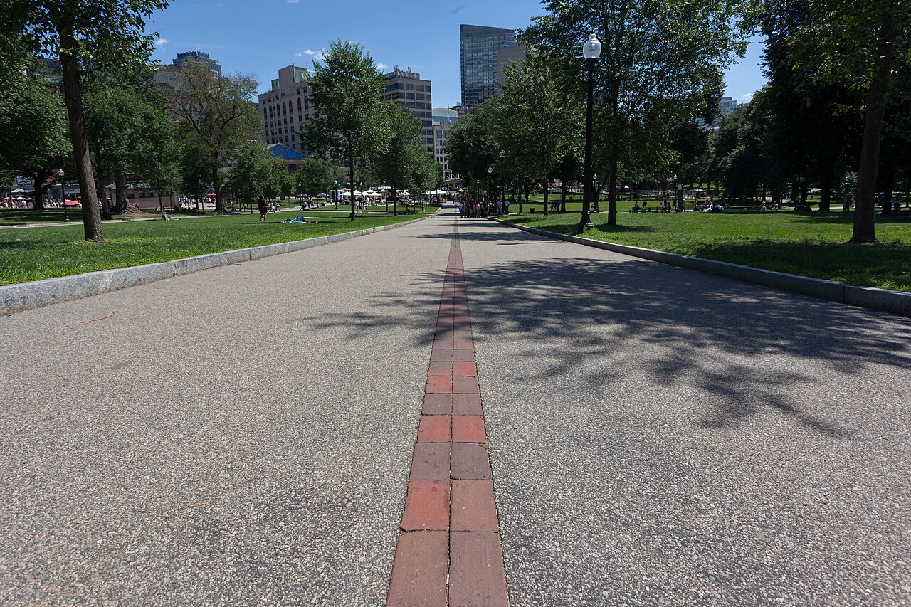
The Freedom Trail is a 2.5-mile (about 4 km) red-brick path through downtown Boston that links 16 historically significant sites of the American Revolution, running from Boston Common to the Bunker Hill Monument in Charlestown. Devised in 1951 by local journalist William Schofield, it lets you follow a single painted line on the ground to see the founding chapter of U.S. history in one compact, walkable route. In 2026, the 250th anniversary of the Declaration of Independence (America250 / Boston 250), the city hosts reenactments and commemorative programming through December 31, so expect larger crowds than usual. Plan it as a half-day to full-day outdoor walk.
Boston Common and the golden-domed Massachusetts State House — the trail's starting point and the oldest public park in the U.S.
Granary Burying Ground — graves of Paul Revere, John Hancock, Samuel Adams, and the victims of the Boston Massacre
The Old State House and the Boston Massacre site marker on the pavement in front of it
Faneuil Hall and Quincy Market — the 'Cradle of Liberty' meeting hall and a lively square full of food stalls
Paul Revere's house and the Old North Church ('one if by land, two if by sea') in the North End, plus USS Constitution and the Bunker Hill Monument across the river in Charlestown
Good to know
SafetyYou'll cover about 4 km over brick and cobblestone, so comfortable walking shoes are essential. Surfaces are uneven and some stretches run beside traffic, so watch your footing and the crossings.
SeasonSummers are hot and humid; winters bring cold, snow, and ice. Most of the route is outdoors, so dress for the season — water and a hat in summer, warm layers and non-slip shoes in winter.
RulesUSS Constitution sits inside an active U.S. Navy base (Charlestown Navy Yard). Entry is free, but visitors 18 and older must show a valid photo ID (such as a passport) and pass a security screening — carry your ID.
MannersSome stops, such as King's Chapel, are still active houses of worship, and the trail passes historic burying grounds. Move quietly and be respectful — don't step on or touch the gravestones.
CautionBuy guided tours and admission tickets from the official Freedom Trail Foundation (e.g., the Boston Common Visitor Center) or each site's box office. Avoid unofficial touts or resellers near the attractions, who may overcharge.
MannersTipping is customary in the U.S. For guided tours and restaurants, plan on roughly 18–20%.
Practical info
The starting point at Boston Common connects directly to Park Street station on the T (Red/Green lines), while the Charlestown end (USS Constitution and Bunker Hill) is near North Station. Following the red line is free and self-guided; the five paid sites (Old State House, Old South Meeting House, Old North Church, Paul Revere House, King's Chapel) and guided tours have fees and hours that vary by site and season, so check the latest details on the official website before you go.
On-site reviews📍 Verified on-site
No reviews yet. If you are here, be the first to leave one.